The Mountains Package designates priority development areas in the Municipalities of Krujë, Maliq and Vora
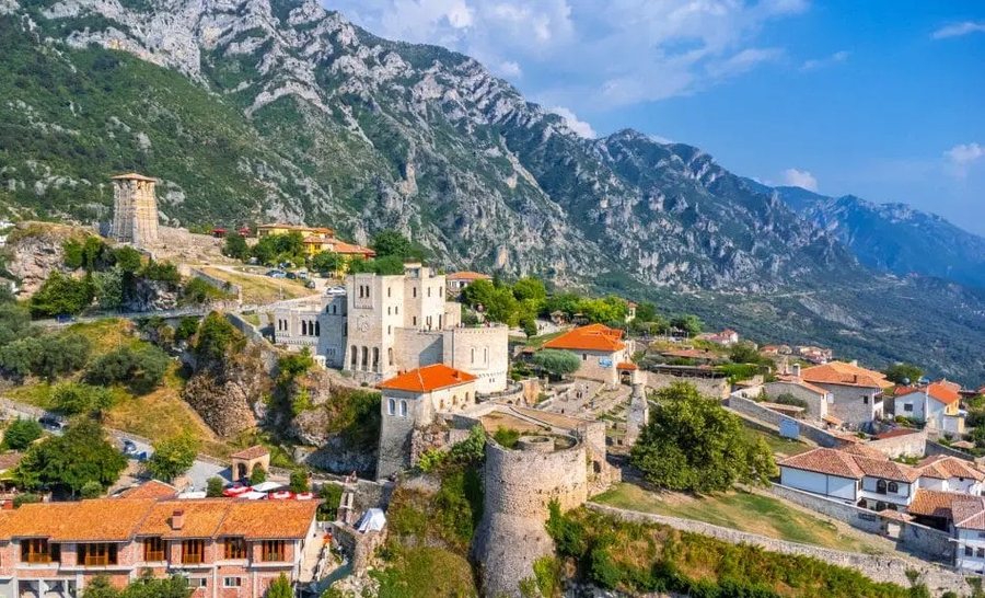
The government has approved priority development areas for agrotourism, part of the Mountain Package in the Municipalities of Kruja, Vora and Maliq.
In Kruja, 5 priority development zones have been designated, in the Municipality of Maliq 10 zones have been designated, while in Vora 6 other zones have been designated.
The government is in the process of approving the designation of these areas, which are seen as having the highest priority for the development of guesthouses and agrotourism. Also, the government's decisions, some of these areas, in addition to tourism, are seen as priorities for economic and industrial development.
DECISION
ABOUT
ANNOUNCEMENT OF SOME AREAS WITH PRIORITY FOR THE DEVELOPMENT OF THE MOUNTAIN ECONOMY IN THE MUNICIPALITY OF KRUJĆA
In support of Article 100 of the Constitution and point 1, Article 4, of Law No. 20/2025, “On the Mountains Package”, upon the proposal of the Minister of State for Local Government, the Council of Ministers
DECIDED:
1. The declaration of "Zone with priority for the development of the mountain economy" in the territory of the Municipality of Krujë, as follows:
a) Zone no. 1, areas Barkanesh, Dane – Fushë Madhe, Bojë, part of the administrative unit of Krujë, with an area of 1258.65 (one thousand two hundred fifty-eight point sixty-five) ha, according to the map in the KRGJSH system presented on the orthophoto;
b) Zone no. 2, Cudhi administrative unit, with an area of 7712.62 (seven thousand seven hundred twelve point sixty-two) ha, according to the map in the KRGJSH system presented on the orthophoto;
c) Zone no. 3, the areas of Picërraga, Brret, Gjyre, Abaze, Krastë, Mali i Krujës, part of the administrative unit of Krujë, with an area of 1917.76 (one thousand nine hundred seventeen point seventy-six) ha, according to the map in the KRGJSH system presented on the orthophoto;
ç) Zone no. 4, Halil, Virjon, Nikël, Zezë, Kurcaj, Buran, Mukaj zones, part of the administrative units of Fushë-Krujë and Nikël, with an area of 2424.28 (two thousand four hundred twenty-four point twenty-eight) ha, according to the map in the KRGJSH system presented on the orthophoto;
d) Zone no. 5, Budull, Bubq, Mazhë-Madhe, Mallkuç zones, part of the Bubq administrative unit, with an area of 1920.2 (one thousand nine hundred twenty point two) ha, according to the map in the KRGJSH system presented on the orthophoto.
2. The extent, boundaries and entry and exit points of these areas are determined on the indicative map, according to the KRGJSH system, which is attached to this decision.
3. The types of activities that will take place in this area are:
a) economic development;
b) industrial development;
c) tourism development.
4. The Ministry of Economy and Innovation, the State Cadastre Agency and the Municipality of Kruja are responsible for the implementation of this decision.
This decision enters into force upon publication in the "Official Gazette".
PRIME
EDI RAMA
***
DECISION
ABOUT
ANNOUNCEMENT OF SOME AREAS WITH PRIORITY FOR THE DEVELOPMENT OF THE MOUNTAIN ECONOMY IN THE MUNICIPALITY OF MALIQ
In support of Article 100 of the Constitution and point 1, Article 4, of Law No. 20/2025, “On the Mountains Package”, upon the proposal of the Minister of State for Local Government, the Council of Ministers
DECIDED:
1. The declaration of "Zone with priority for the development of the mountain economy" in the territory of the Municipality of Maliq, as follows:
a) Zone no. 1, Maliq administrative unit (center), villages Kolanec, Plovisht, Goce, Bickë, Gjyras; Libonik administrative unit, villages Libonik, Pocestë, Klocë, Vloçisht, Symiz, Zboq, Beras, Kembëthekër, Shkozë; Pirg administrative unit, villages Sovjan, Gurishtë, Pirg, Leminot, Shqitas, Kakaç, Veliternë, with an area of 1600.26 (one thousand six hundred point twenty-six) ha, according to the map in the KRGJSH system presented on the orthophoto;
b) Zone no. 1/1, Maliq administrative unit (center), villages Kolanec, Plovisht, Goce, Bickë, Gjyras; Libonik administrative unit, villages Libonik, Pocestë, Klocë, Vloçisht, Symiz, Zboq, Beras, Kembëthekër, Shkozë; Pirg administrative unit, villages Sovjan, Gurishtë, Pirg, Leminot, Shqitas, Kakaç, Veliternë, with an area of 1074.69 (one thousand seventy-four point sixty-nine) ha, according to the map in the KRGJSH system presented on the orthophoto;
c) Zone no. 2, administrative unit Vreshtas and administrative unit Pojan, which includes the villages: Podgorie, Bregas, Vreshtas, Shëngjergj, Zvezdë, Burimas, Zëmblak and Plasë, with an area of 1775.48 (one thousand seven hundred seventy-five point forty-eight) ha, according to the map in the KRGJSH system presented on the orthophoto;
ç) Zone no. 3, which includes the territory of the Moglica administrative unit, with an area of 62.92 (sixty-two point ninety-two) ha, according to the map in the KRGJSH system presented on the orthophoto;
d) Zone no. 4, which includes the territory of the Moglica administrative unit, with an area of 38.25 (thirty-eight point twenty-five) ha, according to the map in the KRGJSH system presented on the orthophoto;
dh) Zone no. 5, which includes the territory of the Moglica administrative unit, with an area of 138.18 (one hundred thirty-eight point eighteen) ha, according to the map in the KRGJSH system presented on the orthophoto;
e) Zone no. 6, which includes the territory of the Moglica administrative unit, with an area of 145.16 (one hundred and forty-five point sixteen) ha, according to the map in the KRGJSH system presented on the orthophoto;
ë) Zone no. 7, which includes the territory of the Moglica administrative unit, with an area of 443.41 (four hundred and forty-three point forty-one) ha, according to the map in the KRGJSH system presented on the orthophoto;
f) Zone no. 8, which includes the territory of the administrative unit of Gora, with an area of 55.96 (fifty-five point ninety-six) ha, according to the map in the KRGJSH system presented on the orthophoto;
g) Zone no. 9, which includes the territory of the administrative unit of Gora, with an area of 62.26 (sixty-two point twenty-six) ha, according to the map in the KRGJSH system presented on the orthophoto;
gj) Zone no. 10, which includes the territory of the administrative unit of Gora, with an area of 864.66 (eight hundred and sixty-four point sixty-six) ha, according to the map in the KRGJSH system presented on the orthophoto;
2. The extent, boundaries and entry and exit points of this zone are determined on the indicative map, according to the KRRGJSH system, which is attached to this decision.
3. The types of activities that will take place in this area are:
a) economic development;
b) industrial development;
c) tourism development.
4. The Ministry of Economy and Innovation, the State Cadastre Agency and the Municipality of Maliq are responsible for the implementation of this decision.
This decision enters into force upon publication in the "Official Gazette".
PRIME
EDI RAMA
***
DECISION
ABOUT
ANNOUNCEMENT OF SOME AREAS WITH PRIORITY FOR THE DEVELOPMENT OF THE MOUNTAIN ECONOMY IN THE MUNICIPALITY OF VORA
In support of Article 100 of the Constitution and point 1, Article 4, of Law No. 20/2025, “On the Mountains Package”, upon the proposal of the Minister of State for Local Government, the Council of Ministers
DECIDED:
1. The declaration of "Zone with priority for the development of the mountain economy" in the territory of the Municipality of Vora, as follows:
a) Zones no. 1 and no. 2, Gërdec village, Vorë administrative unit, with areas, respectively, 13.92 (thirteen point ninety-two) ha and 34.04 (thirty-four point zero four) ha, according to the map in the KRGJSH system, presented on the orthophoto;
b) Zone no. 3, Marikaj village, Vora administrative unit, with an area of 32.84 (thirty-two point eighty-four) ha, according to the map in the KRGJSH system, presented on the orthophoto;
c) Zone no. 4, Kuç village, Vora administrative unit, with an area of 21.29 (twenty-one point twenty-nine) ha, according to the map in the KRGJSH system, presented on the orthophoto;
ç) Zone no. 5, Palaq village, Prezë administrative unit, with an area of 3.27 (three point twenty-seven) ha, according to the map in the KRGJSH system, presented on the orthophoto;
d) Zones no. 6 and no. 7, Prezë village, Prezë administrative unit, with areas, respectively, 8.99 (eight point ninety-nine) ha and 11.95 (eleven point ninety-five) ha, according to the map in the KRGJSH system, presented on the orthophoto.
2. The extent, boundaries and entry and exit points of these areas are determined on the indicative map, according to the KRGJSH system, which is attached to this decision.
3. The types of activities that will take place in this area are:
a) economic development;
b) industrial development;
c) tourism development.
4. The Ministry of Economy and Innovation, the State Cadastre Agency and the Municipality of Vora are responsible for the implementation of this decision.
This decision enters into force upon publication in the "Official Gazette".
PRIME
EDI RAMA

Appointments, Shkëlqim Hajdari Prefect of Tirana, Dashnor Sula Chief Inspector
The government has made official two new appointments at the head of the General Inspectorate and at the head of the Tirana Prefecture. Dashnor Sula is......

Another former finance minister in the Supervisory Council of the Bank of Albania, the government proposes Ervin Mete
Another former finance minister is expected to be added to the Supervisory Board of the Bank of Albania. The government has approved its two candidacies......
VKM, the government "increases" the salaries of the President, the Judiciary, the Guard, the Police, Prisons and Health (DECISIONS)
At its meeting today, the government has taken several decisions on salary interventions. The indexation of the Salary of the President of the Republic by......

How much does it cost to get certified for Europe? - Pilku: Production and processing standards, one of the challenges of the EU
Production and processing standards are becoming increasingly crucial for agricultural businesses targeting the European market. Product certification is......

Data centers in Albania - The challenge for electricity, from increasing production capacities to investments in the network
As an Israeli company aims to build the first data center in Albania, attention for this investment is also focused on electricity. This is because these......

Works on the Librazhd-Përrenjas segment/ ARRSH: Traffic is now operating normally
The Albanian Road Authority announces that works have been completed on the Librazhd-Përrenjas segment, in the village of Dragostunjë, where traffic is now......

Map of bank savings in Albania - Tirana "unrivaled", holds almost half of national deposits in 2025. Durrës, second
Tirana continues to convincingly lead the list of regions with the highest level of bank savings, while Lezha, Shkodra, Elbasan and Korça remain among the......

Government approves criminal amnesty - 447 people are immediately released from prison. Sentences reduced for 853 convicts
At today's meeting, the Council of Ministers approved the draft law on criminal amnesty, which provides for the immediate release from prison of 447 people......